rareoldprints.com


Search

If you know the reference number
enter it here:


If you enter more than one word
it will be treated as phrase.

Insert "and" or "or" between words to search for the words in any order.

Refine your search here or build another search.
Displaying 10 to 20 of 62 - Next - Previous
92%
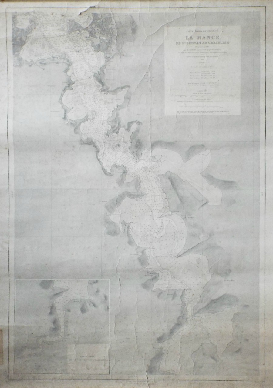
Cote Nord de France - La Rance de St.Servan au Chatelier, North France
Ref: P/23553
Region: La Rance
Type: Lithograph
Engraver: Dyonnet A
Date: 1932

92%
2d. Chart of the Coast of France, from Ostend to Ambletense.
Ref: P/28287
Region: Dunkerque
Type: Copper
Engraver: Jefferys T

92%
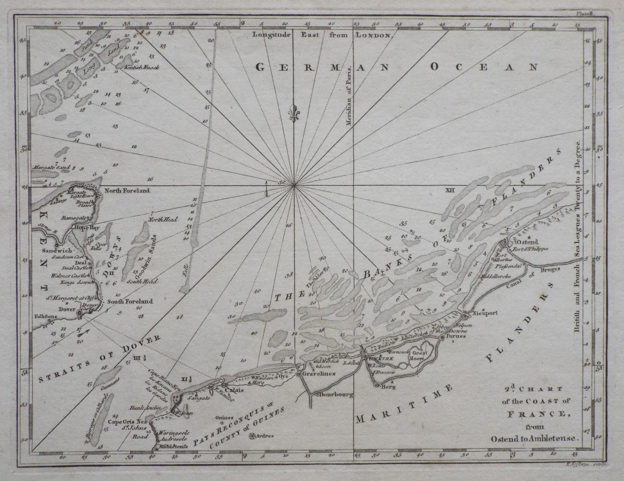
A Plan of Gravelines, with the New Canal and the Course of the River Aa to the Sea.
Ref: P/28289
Region: Gravelines
Type: Copper
Engraver: Jefferys T

92%
Plan of Dunkirk, and the Canal of Mardick, as they were in 1757.
Ref: P/28283
Region: Dunkerque
Type: Copper
Engraver: Jefferys T

92%
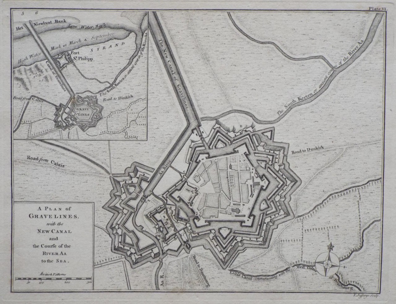
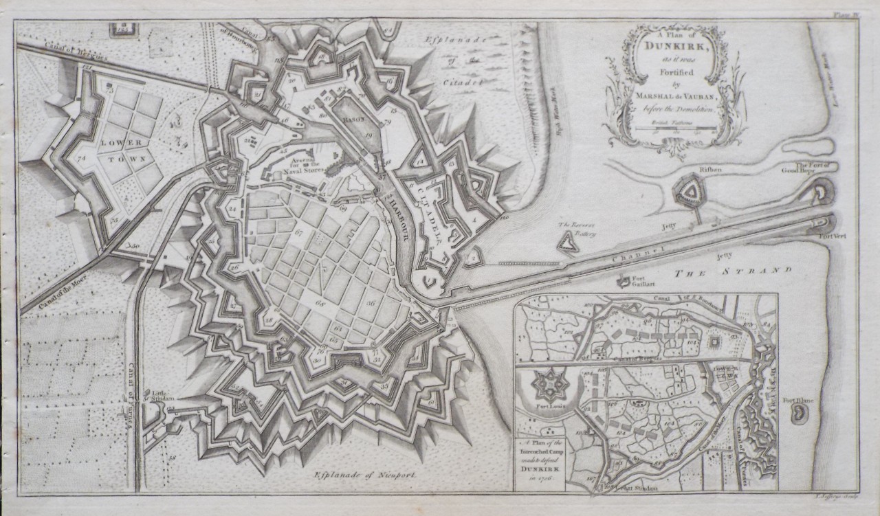
A Plan of Dunkirk, as it was Fortified by Marshal de Vauban, before the Demolition.
Ref: P/28288
Region: Dunkerque
Type: Copper
Engraver: Jefferys T

91%
Atlas National. Plan de Roubaix et de Tourcoign
Ref: P/30267
Region: Roubaix
Type: Chromo-lithograph
Engraver: Hausermann R
Publisher: Artheme Fayard, Editeur Bol St. Michel 78
Date: 1877

91%
Atlas National. Plan de Douai
Ref: P/30265
Region: Douai
Type: Chromo-lithograph
Engraver: Hausermann R
Publisher: Artheme Fayard, Editeur Bol St. Michel 78
Date: 1877

91%
Atlas National. Plan de Dunkerque
Ref: P/30264
Region: Dunkerque
Type: Chromo-lithograph
Engraver: Hausermann R
Publisher: Artheme Fayard, Editeur Bol St. Michel 78
Date: 1877

91%
Atlas National. Plan de Valenciennes
Ref: P/30262
Region: Valenciennes
Type: Chromo-lithograph
Engraver: Hausermann R
Publisher: Artheme Fayard, Editeur Bol St. Michel 78
Date: 1877

91%
Atlas National. Plan de St. Omer | Atlas National. Plan de Cambrai
Ref: P/30257
Region: Saint-Omer and Cambrai
Type: Chromo-lithograph
Engraver: Hausermann R
Publisher: Artheme Fayard, Editeur Bol St. Michel 78
Date: 1877


Displaying 10 to 20 of 62